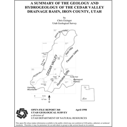
A summary of the geology and hydrogeology of the Cedar Valley drainage basin, Iron County, Utah (OFR-360)
By: C. Eisinger The Cedar Valley drainage basin encompasses more than 580 square miles (1,502 km2) in southwestern Utah. Located in the transition zone between the Basin and Range and Colorado Plateau physiographic provinces, the drainage basin includes Cedar Valley, the Hurricane Cliffs, and the western part of the Markagunt Plateau. The exposed geology of the area includes rocks of Paleozoic, Mesozoic, and Cenozoic age, with an aggregate thickness of more than 16,000 feet (4,877 m). The region witnessed an episode of calc-alkaline volcanism during the late Eocene, Oligocene, and early Miocene, and then a period of more passive volcanism beginning in the mid-Miocene. Basin-and-range extension formed Cedar Valley through large-scale normal faulting and subsequent erosion. Quaternary alluvium and volcanic deposits more than 1,000 feet thick underlie the floor of Cedar Valley. This alluvial valley fill is the principal aquifer in the basin. Ground water in Cedar Valley exists und